Event Management
Tangles Events
Tintabee hosts an events management platform built for communities and in particular youth groups. The platform and its mobile apps are free to download and use for event participants. Signing up and setting up a community is free and there is currently no charge for running community scale events.
Find it at www.tanglesevents.com
Youth centric event management
Tangles Events is a youth centric events management platform which offers a suite of features for youth leaders and community groups to plan, coordinate and deliver successful meetings and events safely and securely.
End users can access the platform via the web or via the full-featured mobile application which also provides a secure messaging platform and a safe environment in which participants can interact face to face and via secure communications.
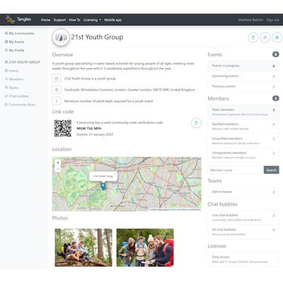
The core platform with allows you to manage your community members' details, your events, event sign-up and attendance, allowing members only or general public sign-up via the app, using QR codes and more.
Publish your events on the Tangles Events platform or on your own website using the WordPress plugin
"Keeping young people safe should be the top priority of anyone working with them. It’s vital that the spaces they are in are safe and that the people they are in contact with are trustworthy" (National Youth Agency)

Built in secure and safe chat
Chat groups can be enabled for community teams or for specific events. Everyone in the chat is identified and controls such as prohibiting one to one chat ensuring defined adult to youth ratios in chats make the chat space a safe one.
The whole chat history is avaialble to all participants whenerver they join the group.

A whole suite of optional features
In addition to the core features, additional options allow you to:
- Plan food and menus using participant dietary information
- Record first aid and other incidents
- Record allergies and relevant health information
- Capture participant information and consent via user defined forms and checklists
- Create teams within your community and event specific teams
- Enable chat groups for your events and teams
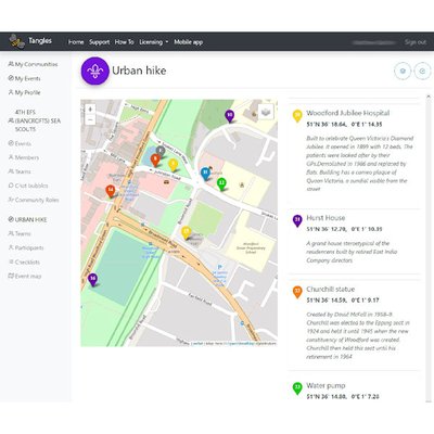
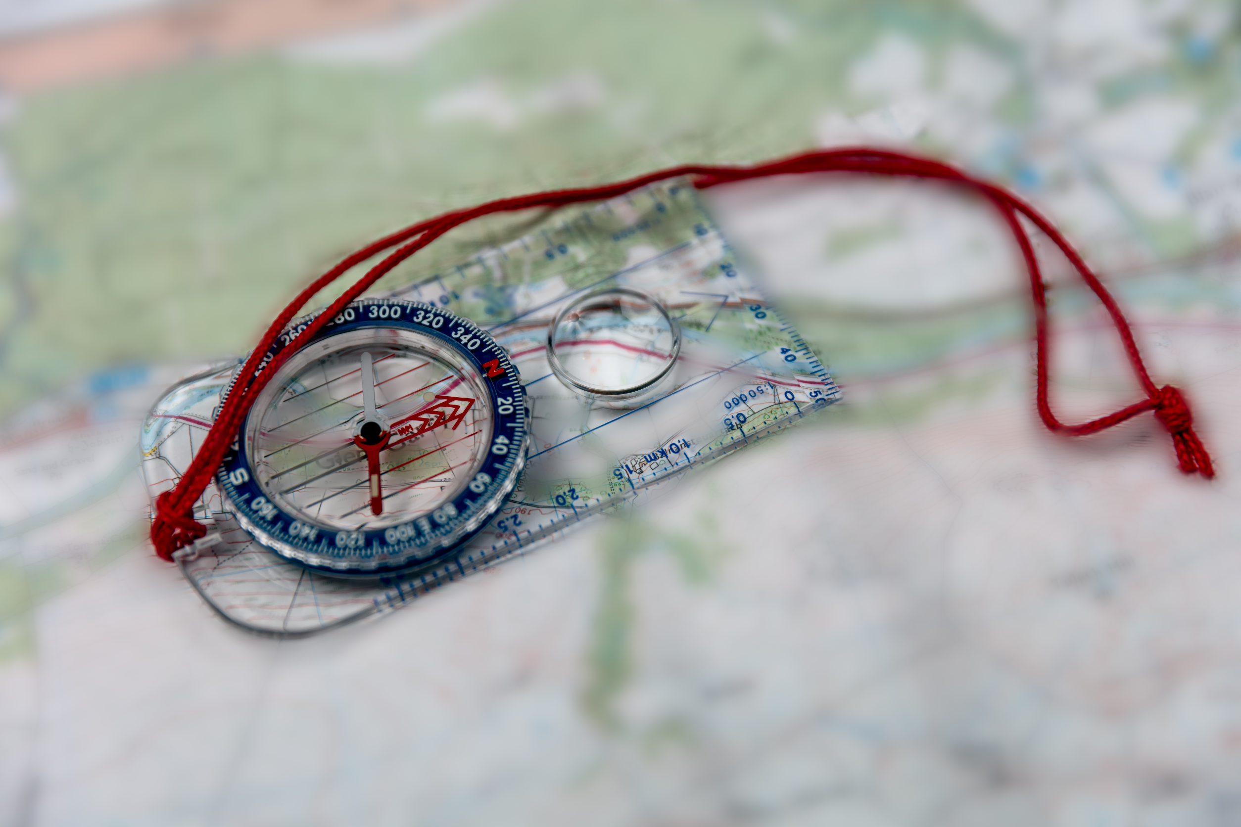
Competitive route planning and tracking
Easily create orienteering or hike waypoints and routes for your participants. Create layered maps including bounderies and facilities. Allow your event teams to independently plan competing routes based on common waypoint markers.
Manage start and end times, waypoint arrival times and your participants' real time location during the event and review actual versus planned routes after the event.
You decide what information participants can access on their mobile devices - GPS location, route map , route plan or print physical map copies instead using OpenStreetMap or UK Ordnance Survey EPSG:3857 base maps.
Whether hiking, geocaching, orienteering, competitively or collaboratively or merely setting up information maps for your event, the options are there.